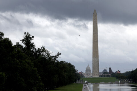
On the first day of July, a hot, muggy morning gave way to severe weather Tuesday afternoon and thunderstorms likely extending into the evening hours.
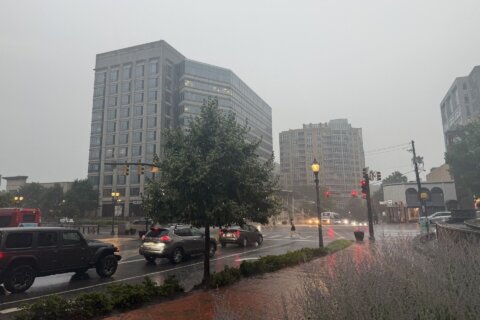
A large system of severe thunderstorms slammed into the heart of the D.C. region just before 3 p.m., triggering a wave of severe thunderstorm watches and food watches throughout much of the latter half of the day.
Ground stops were lifted for Dulles International, BWI Marshall Airport and Reagan National after hours’ worth of holds were prompted by storms in the region.
WTOP Meteorologist Mike Stinneford reported that wind gusts at the Bay Bridge had been clocked at 4:34 p.m. at a speed of 49 mph.
Several reports of damage began coming into the weather service around 3:30 p.m., including reports of large tree limbs down across southern Arlington and a tree that fell onto a car on Old Frederick Road in Sykesville.
7News First Alert Meteorologist Eileen Whelan earlier warned that “storms could contain damaging wind gusts and hail.”
The storms are being whipped up by a strong cold front, which will eventually bring a drop in humidity. Until then, the cold front means rain chances will continue Tuesday night into Wednesday morning.
But fear not: Fourth of July weather “looks great,” Whelan said. Expect low humidity with temperatures around 90. Then, look for dry weather the rest of the holiday weekend.
- Listen to WTOP online and on the radio at 103.5 FM or 107.7 FM.
- Current traffic conditions
- Weather forecast
- Closings and Delays
- Sign up for WTOP email alerts
- Get custom alerts with the WTOP app for Apple and Android phones
Forecast
LATE TUESDAY AFTERNOON AND EVENING: SEVERE ALERT
Strong to Severe PM Storms
Temperatures: 90s to 80s
Winds: Southwest 10-15 mph
A strong cold front will continue to move across the DMV this afternoon and into the evening bringing gusty winds and pockets of moderate to heavy rain. A severe thunderstorm watch has been posted until 9 p.m. Plan for elevated warnings as the system works its way across the Mid-Atlantic. A flood watch has been posted until 11 p.m. FIRST ALERT WEATHER remains on severe and flood alert through the evening.
TUESDAY NIGHT: Scattered Showers, Storms End
Lows: 68-75
Winds: Southwest 5 mph
Wet weather chances continue overnight with mild and muggy conditions. Pockets of heavy rain could lead to standing water, so use caution on area roadways.
WEDNESDAY: Morning showers; Afternoon clearing
Highs: 83-88
Winds: North 5-10 mph
Scattered showers will linger during the morning hours with humidity levels remaining high. The actual cold front will push through midday shifting our wind direction out of the northwest ushering in a drier airmass. Skies will brighten during the afternoon with highs in the 80s.
THURSDAY: Mostly sunny
Highs: near 90
Winds: Northwest 5-10 mph
Cooler weather will be nice to kick-start the day with wake-up temperatures in the 60s in the suburbs. Plan for abundant sunshine and highs in the middle 80s to around 90 degrees with lower humidity.
FRIDAY: INDEPENDENCE DAY
Mostly Sunny
Highs: 83-88
Winds: Northwest 5-10 mph
Fantastic weather is expected for the 4th of July with sunshine, comfortable high temperatures in the mid 80s, and low humidity for early July.
CURRENT CONDITIONS
Get breaking news and daily headlines delivered to your email inbox by signing up here.
© 2025 WTOP. All Rights Reserved. This website is not intended for users located within the European Economic Area.