Soaring temperatures in the D.C. region has shuttered the towering Washington Monument through Tuesday, as the District activates its heat emergency plan.
D.C. opened its cooling centers across all eight wards. The warning is simple: Take this seriously or risk serious consequences.
The National Weather Service has D.C. under an Excessive Heat Warning through at least Tuesday night, with actual temperatures around 100 degrees and “feels like” temperatures of 105 to 110 degrees.
“We had 90s over the weekend and boy, the next couple of days we’re pushing 100 degrees,” said. 7News First Alert Senior Meteorologist Brian van de Graaff, adding that it will be the actual temperature, and not the “feels like” temperature, which will be a lot higher.
He added that because it’s been awhile since the D.C. area has seen temperatures like this, we’re not used to it.
Heat Advisories and Extreme Heat Warnings are in effect for the day on Monday. Heat indices of 100 to up to 110 degrees expected. Extreme Heat Watches continue on Tuesday. pic.twitter.com/Or2XeYNp3b
— NWS Baltimore-Washington (@NWS_BaltWash) June 22, 2025
“It’s just extreme and our bodies are not accustomed to it,” van de Graaff said. “We have to really take care and make sure we drink plenty of fluids, try to stay cool and stay out of the sun.”
An Extreme Heat Warning is in effect for the D.C. and Baltimore metro areas until 9 p.m.
“That heat will still be lingering tonight,” van de Graaff said. “It’s pretty intense.”
There won’t be a lot of relief Monday night as temperatures will be in the upper 70s to low 80s.
He said heat is the No. 1 “weather killer” in the U.S., so “we have to look out for one another.”
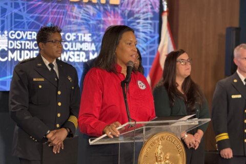
D.C. Mayor Muriel Bowser has activated an Extreme Heat Alert for the District through 8 a.m. Wednesday.
Bowser’s administration said libraries, recreation centers and senior wellness facilities are all open as designated relief spots. Metro stations are not on the list, so don’t count on waiting underground to beat the heat.
If you see someone struggling — especially seniors or unhoused residents — call the Hypothermia/Hyperthermia Hotline at 202-399-7093. Outreach teams are actively trying to get people indoors.
Trash collection is also shifting earlier, and expect delays in public services and construction projects.
A few heat survival tips worth repeating:
- Drink water, constantly, even if you’re not feeling like a fish.
- Stay indoors during peak heat hours (10 a.m. to 6 p.m.).
- Don’t leave pets or people in cars. Ever.
- Wear light clothing and use fans or air conditioning if available.
And if you’re someone who’s been brushing off heat warnings? Don’t. This kind of heat can lead to death in certain situations.
Day centers and shelters
There are also walk-in services at Day Centers for those experiencing homelessness. Appointments are not required, but are available on a first-come, first-served basis at the following locations:
- Downtown Day Services Center — 1313 New York Avenue NW
- Monday through Friday from 9 a.m. to 7 p.m. (extended hours during Extreme Heat Alert)
- Saturday from 10 a.m. to 3 p.m.
- Adams Place Day Center — 2210 Adams Place NE
- Monday through Friday from 9 a.m. to 5 p.m.
- 801 East Day Center — 2722 MLK Jr. Avenue SE
- Monday through Friday from 9 a.m. to 5 p.m.
Check the full list of open cooling centers online, or, take advantage of the map released by the District to find the nearest cooling center to you. Be cool — literally.
Forecast
LATE MONDAY AFTERNOON/EVENING:
Mostly sunny
Temperatures: 90s
Heat Index: 100-110
Winds: South 5-10 mph
An extreme heat warning is in effect for a large portion of the DMV until 9 p.m. Heat index values during this time will range from 105 to 110 degrees. Record-high temperatures are possible.
OVERNIGHT:
Mainly clear
Lows: Near 80
Winds: Light
Temperatures will not cool much overnight with temperatures only falling into the upper 70s to low 80s.
TUESDAY: HEAT ALERT
Mostly sunny, very hot
Highs: 97-102
Heat Index: 105-110
Winds: Southwest 5-10 mph
Sizzling hot temperatures and high humidity continue across the area. Limit time outdoors during the hottest time of the day. Drink more water than usual. Wear light-colored and loose-fitted clothing. An extreme heat warning has been posted for the day.
WEDNESDAY: HEAT ALERT
Partly cloudy
Highs: 94-100
Heat Index: 100-108
Winds: Northwest 5 mph
Temperatures remain high near 100 degrees, but some areas may see a decrease in high temperatures to the upper 90s. Once again, limit time outdoors during the hottest time of the day. Drink more water than usual. Wear light-colored and loose-fitted clothing.
THURSDAY: HEAT ALERT
Sunny, isolated storm chance
Highs: 93-98
Heat Index: 99-105
Winds: Northwest 5 mph
Temperatures begin to come down a few degrees as storm chances increase to 30% during the afternoon and evening. Widespread severe weather is not expected at this time.
Get breaking news and daily headlines delivered to your email inbox by signing up here.
© 2025 WTOP. All Rights Reserved. This website is not intended for users located within the European Economic Area.