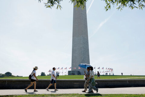
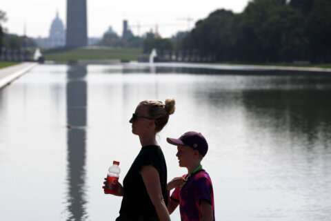
With sweltering heat hitting D.C., Mayor Muriel Bowser issued a Heat Alert for Sunday, with an Extreme Alert planned for Monday through Wednesday.
The Heat Alert means cooling centers in the District will be open and available for anyone needing to get out of the sweltering conditions.
The heat index could get up to 104 degrees on Sunday and up to 110 degrees from Monday through Wednesday.
As part of the alert, the District released a map marking all cooling centers established throughout the nation’s capital. Find the closest cooling center to you online.
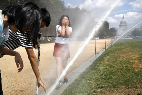
Another cooling option is a D.C. pool or spray park. The spray parks are open daily from 10 a.m. to 6 p.m. You can find the locations online.
If you’re considering heading to a pool, there is a listing and schedule for all of the D.C. outdoor pool locations and the indoor pools, which are available year-round.
Heat safety precautions
The District encourages you to check on each other in the heat and to stay hydrated.
Tips for hot weather include:
- Drink a lot of water and avoid caffeinated and alcoholic beverages during extreme heat
- Take frequent breaks and rest in cool, shady areas
- Close the shades on windows that receive sun during the day
- Wear loose clothing and sunscreen
- Take cold showers to lower your body temperature
- Create makeshift air conditioning by putting a bowl of ice or cold water in front of your fan
- Don’t leave kids or pets alone in cars. If you see an animal left outside or in a vehicle on a hot day, call the Brandywine Valley SPCA at 202-888-PETS.
- Take your pet and/or service animal out in the morning or evening when temperatures are cooler
- Keep your emergency kit available in an easy-to-reach location in case of an emergency
Day centers and shelters
There are also walk-in services at local Day Centers for those experiencing homelessness. Appointments are not required, but are available on a first-come, first-served basis at the following locations:
- Downtown Day Services Center — 1313 New York Avenue NW
- Monday through Friday from 9 a.m. to 7 p.m. (extended hours during Extreme Heat Alert)
- Saturday from 10 a.m. to 3 p.m.
- Adams Place Day Center — 2210 Adams Place NE
- Monday through Friday from 9 a.m. to 5 p.m.
- 801 East Day Center — 2722 MLK Jr. Avenue SE
- Monday through Friday from 9 a.m. to 5 p.m.
There is a drop-in center for young adults experiencing homelessness called Zoe’s Doors Youth Drop-In Center. The facility, which is open 24 hours, caters to residents 18 to 24, and is located at 900 Rhode Island Avenue NE. Appointments are recommended.
There are also low-barrier shelters for individuals experiencing homelessness available that are open 24 hours. These include:
- New York Avenue Men’s Shelter — 1355 New York Avenue NE
- 801 East Men’s Shelter — 2722 MLK Jr. Avenue SE
- Adams Place Men’s Shelter — 2210 Adams Place NE
- Emery Men’s Shelter — 1725 Lincoln Road NE
- Pat Handy Women’s Shelter — 810 5th Street NW
- Harriet Tubman Women’s Shelter — 1910 Massachusetts Avenue SE
- Living Life Alternatives LGBTQ+ Shelter — 400 50th Street SE
If you need a ride to one of the homeless shelters, call the D.C. Shelter Hotline at 202-399-7093, between the hours of 8 a.m. to 12 a.m., or the Mayor’s Citywide Call Center at 311 at any time.
Forecast
SUNDAY EVENING:
Mostly sunny
Temps: 90s
Winds: South 5-10 mph
Temperature slowly dipping into the 80s this evening with partly cloudy skies.
OVERNIGHT SUNDAY:
Mostly clear
Lows: 72-80
Winds: West 5-10 mph
Temperatures will not cool off as much over the next few days due to extreme heat. The morning hours will start off very mild from the middle 70s to the low 80s.
MONDAY: HEAT ALERT
Mostly sunny, very hot
Highs: 96-100
Heat Index: 104-110
Winds: South 5-10 mph
The first day of prolonged heat in the Mid-Atlantic thanks to a heat dome weather pattern. An Extreme Heat Warning is in effect for the DC and Baltimore metro areas from 11 a.m. to 9 p.m. Heat index values during this time will range from 105 to 110 degrees.
TUESDAY: HEAT ALERT
Mostly sunny, very hot
Highs: 97-101
Heat Index: 105-109
Winds: Southwest 5-10 mph
Sizzling hot temperatures and high humidity continue across the area. Limit time outdoors during the hottest time of the day. Drink more water than usual. Wear light-colored and loose-fitted clothing.
WEDNESDAY: HEAT ALERT
Partly cloudy and hot
Highs: 94-99
Heat Index: 101-105
Winds: Northwest 5 mph
Temperatures remain high near 100 degrees, but some areas may see a decrease in high temperatures to the upper 90s. Once again, limit time outdoors during the hottest time of the day. Drink more water than usual. Wear light-colored and loose-fitted clothing.
THURSDAY: HEAT ALERT
Sunny and Hot
Highs: 93-97
Heat Index: 99-102
Winds: Northwest 5 mph
Temperatures begin to come down a few degrees as storm chances increase to 30% during the afternoon and evening. Widespread severe weather is not expected at this time.
Get breaking news and daily headlines delivered to your email inbox by signing up here.
© 2025 WTOP. All Rights Reserved. This website is not intended for users located within the European Economic Area.