The first weekend of the summer season is coming in hot, with blazing heat and humidity on the way for the D.C. region.
Friday marked the last day with milder weather for a bit as humid conditions remained at a low, but that comes to an end by Sunday, when forecasters warn that “feels-like” temperatures will be at or above the 100s.
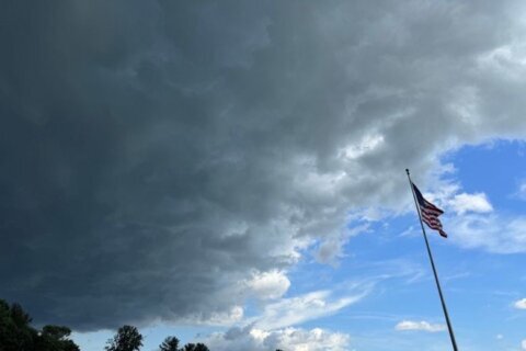
“Besides a few passing clouds, a really nice afternoon shaping up around the DMV on this first full day of summer with temperatures reaching the low 90s, and that humidity slowly beginning to creep on up,” 7News First Alert Meteorologist Mark Peña said.
Overnight temperatures, he said, will fall to the mid 70s before things skyrocket for Sunday, when the D.C. region is forecast to approach readings of 100 degrees. For some, it may feel as hot as 105 degrees, according to Peña.
From Monday through Wednesday, “We could see three consecutive days of triple digit heat,” he added.
With the peak of the heat wave set for Monday and Tuesday, dew point levels are forecast to make the heat extra difficult, thanks to the high water contents in the air.
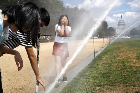
“That’s when it feels really swampy and sticky and really uncomfortable,” 7News First Alert Meteorologist Steve Rudin told WTOP. “Because it’s so humid and so sticky, you’re going to sweat almost instantly once you get outside.”
“It’s not going to be very windy. The air is going to be fairly stagnant, and we’ll also be looking at some hazy conditions,” Rudin said, underscoring weather conditions were “going to be incredibly uncomfortable.”
The latest string of high temperatures is being caused by what officials are calling a heat dome, which the National Oceanic and Atmospheric Administration says is linked to the jet stream and occurs when high pressure atmospheric conditions trap heat over a particular area.
The National Oceanic and Atmospheric Administration states the phenomenon “can linger for days to weeks.”
Although the National Weather Service has yet to file any alerts for the looming weather event, the agency does urge the public to drink plenty of water, pullback on any strenuous activities and check in on any seniors or vulnerable neighbors during extreme heat events.
- Listen to WTOP online and on the radio at 103.5 FM or 107.7 FM.
- Current traffic conditions
- Weather forecast
- Closings and Delays
- Sign up for WTOP email alerts
- Get custom alerts with the WTOP app for Apple and Android phones
FORECAST
SATURDAY: Sunny and Hot
Highs: 90-95
Winds: Southwest 5-10 mph
Sunny and getting hot. Humidity will be on the increase as the day progresses.
SUNDAY: HEAT ALERT
Mostly Sunny, Hot
Highs: 93-98
Winds: Southwest 5-10 mph
Heat and humidity will continue to build across the DMV Sunday with highs well into the 90s and feels like at or above 100 at times.
MONDAY: HEAT ALERT
Mostly Sunny, Hot
Highs: 95-100
Heat Index: 100-110
Winds: Southwest 5-10 mph
Sizzling hot temperatures an oppressive humidity may bring active heat alerts from the National Weather Service.
TUESDAY: HEAT ALERT
Sunny and Hot
Highs: 96-101
Heat Index: 105-110
Winds: Northwest 5 mph
The third day in a row with temperatures close to or exceeding 100 degrees. The record high could be in jeopardy, which is 100 set back in 2010.
CURRENT CONDITIONS
Get breaking news and daily headlines delivered to your email inbox by signing up here.
© 2025 WTOP. All Rights Reserved. This website is not intended for users located within the European Economic Area.