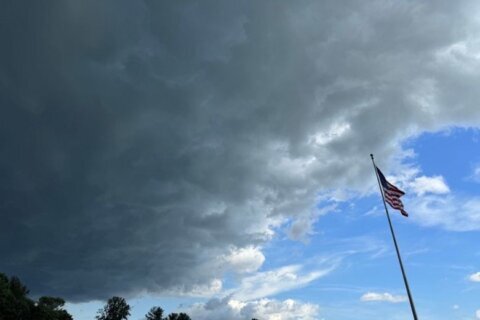
It’s officially summer and the D.C. region’s first heat wave is forecast to start on Sunday, just days after damaging storms toppled trees onto homes and cars in the area.
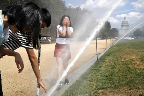
Temperatures are expected to reach 100 degrees next week, but the humidity will make it feel even hotter.
“We’re going to get progressively hotter Sunday, Monday, Tuesday, Wednesday, even into Thursday of next week,” said 7News First Alert Meteorologist Steve Rudin.
A heat wave is defined by the National Weather Service as a period of abnormally hot and humid weather that lasts more than two days.
The peak of the heat wave will come Monday and Tuesday, with heat index values as high as 105 to 110 degrees. Dew point levels, or the measure of moisture in the air, are going to be well into the 70s.
“That’s when it feels really swampy and sticky and really uncomfortable,” Rudin said. “Because it’s so humid and so sticky, you’re going to sweat almost instantly once you get outside.”
Making matters worse, residents across the D.C. region aren’t expected to even get much relief from the humidity by the time the sun goes down.
“It’s still going to be incredibly uncomfortable,” Rudin said. “It’s not going to be very windy. The air is going to be fairly stagnant, and we’ll also be looking at some hazy conditions.”
A dry pattern sets up for the next several days, but with increasing heat starting this weekend. Well above normal temperatures are looking likely from Sunday through Wednesday. Afternoon heat indices approach 100-110 degrees at times during this period. #MDwx #VAwx #DCwx #WVwx pic.twitter.com/tQo7rvujK3
— NWS Baltimore-Washington (@NWS_BaltWash) June 20, 2025
It’s likely parts of the D.C. region will see heat advisories and excessive heat alerts.
Some safety measures to keep in mind include minimizing direct sun exposure, reducing strenuous activities, wearing light clothing and drinking plenty of water, according to the National Weather Service.
- Listen to WTOP online and on the radio at 103.5 FM or 107.7 FM.
- Current traffic conditions
- Weather forecast
- Closings and Delays
- Sign up for WTOP email alerts
- Get custom alerts with the WTOP app for Apple and Android phones
FORECAST
FRIDAY: Mostly sunny, less humid
Highs: 83-88
Winds: West 5-10 mph
The summer solstice occurs at 10:41 p.m. marking the longest amount of daylight all year. Stellar summer weather is expected to kick off the season with sunshine, seasonably warm highs in the 80s, and lower humidity. Enjoy it because an intense heat wave will build heading into the weekend.
FRIDAY NIGHT: Scattered clouds
Lows: 60s
Winds: Calm
Nice weather continues into the overnight with a few passing clouds and temperatures in the 60s.
SATURDAY: Sunny and hot
Highs: 90-95
Winds: Southwest 5-10 mph
Sunny and getting hot. Humidity will be on the increase as the day progresses.
SUNDAY: HEAT ALERT
Mostly sunny, hot
Highs: 93-98
Winds: Southwest 5-10 mph
Heat and humidity will continue to build across the DMV Sunday with highs well into the 90s and feels like at or above 100 at times.
MONDAY: HEAT ALERT
Mostly sunny, hot
Highs: 95-100
Winds: Southwest 5-10 mph
Sizzling hot temperatures an oppressive humidity may bring active heat alerts from the National Weather Service.
CURRENT CONDITIONS
Get breaking news and daily headlines delivered to your email inbox by signing up here.
© 2025 WTOP. All Rights Reserved. This website is not intended for users located within the European Economic Area.